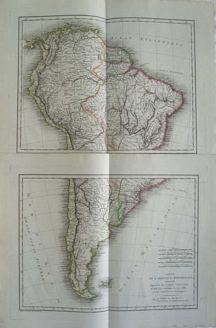
South America.
Mentelle, E & Chanlaire, P.G.
Tardieu, P.A.F.
Map of South America drawn after the observations and maps of Messers de la Condamine, La Cruz, Ulloa, Antoine Cornel et Jean Langara. "
Carte de l'Amérique Méridionalé, Dressée d'aprèsles Observations et les Cartes de MM. de la Condamine, La Cruz, Ulloa, Antoine Cornel et Jean Langara." Paris E. Mentelle & P.G. Chanlaire. 1806
Copper engraved map on two sheets from Mentelle Chanlaire's "
Atlas Universale de géographie physique et politique, ancienne et moderne" engraved by Tardieu. Original outline colour; verso blank. Dark impression; clean and bright.
MENTELLE Edme, 1730-1815.,
Poet. - Geographer and historian. - Professor of history and geography at the Ecole Militaire, Paris (1760-1792). - Professor of Geography at the Ecole Normale Superieure, Paris (1794-1795). - Member of the Institute, Academy of Moral and Political Science, Geography section (elected in 1795), and history and ancient literature (elected in 1803) .
Chanlaire, Pierre-Grégoire, 1758-1817
Publisher, distributor, and printer
was a awyer at the Parliament of Paris in 1780. The French Revolution led him to cultivate geographical disciplines. Appointed in the early 19th century to the central administration of Forestry. From 1803 to 1808 director of the geometry course and topographic Registry Office. In 1808 he began to publish the first issues of the topographical and statistical description of France.
370 by 480mm (14½ by 19 inches).each sheet to plate mark.
ref: 2572
€200