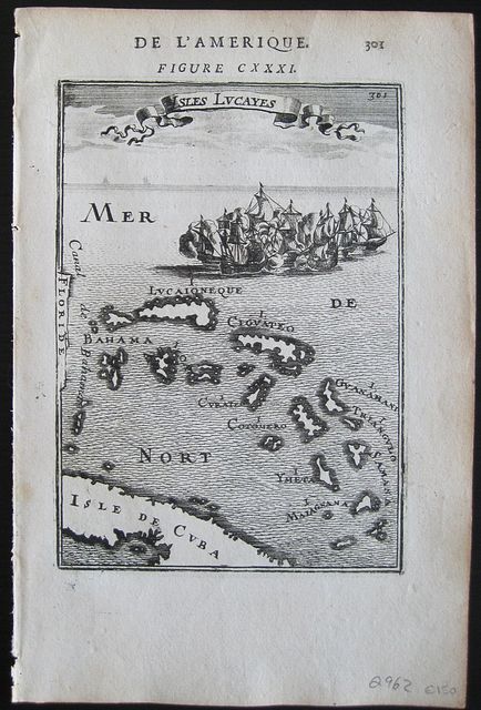
The Bahamas.
Mallet, Allain Manesson.
Bahamas. Isles de Lucayes. Paris. Thierry. Denys. 1683
Copper engraved map of the Bahamas from Mallet's "Description de l'Univers" 1st edition. Text to verso.
The map shows the Bahama islands otherwise the Isles de Lucayes; each is named. Part of Cuba to the South and the coast of Florida to the west.
Large fleet of Ships. Dark impression; very light toning.
Allain Manesson Mallet 1630- 1706, French cartographer, engineer and mathematician, served in the army of Louis XIV, and also that of the King of Portugal later becoming Inspector of Fortifications to Louis. He published the "Description de l'Univers" in 1683, attempting to describe the cartography, towns, ports, people, habits and traditions of the known world. The work extended to 5 volumes with some 600 illustrations.
His other works were"Les Travaux de Mars, ou L'art de la Guerre" 1684, and "La geometerie Practique" 1702.
150 by 105mm (6 by 4¼ inches).
ref: 2962
€150