MAPS & VIEWS
PRINTS
BOOKS


The Pirate Port of Gigery, Jijel, Algeria.
 Jacob van Meurs.
The Town of Gigeri. "De Stadt Gigeri. La Ville Gegery" Amsterdam Wolfgangh, Waesbergen, Boom. Someren en Goethals 1686
Jacob van Meurs.
The Town of Gigeri. "De Stadt Gigeri. La Ville Gegery" Amsterdam Wolfgangh, Waesbergen, Boom. Someren en Goethals 1686Copper engraved double page view of theport of Gigeri [Jijel,] Algeria , from Olfert Dapper's "Description de l'Afrique," the first edition in French; black and white, verso blank; key in the upper corners in Dutch & French.
The view shows the town of Gigeri, [now Jijel] Algeria; ships and galleys to foreground
Under the Ottomans, the city of Jijel became an important port for pirate activity, it was the city of many renowned privateers, including the Brothers Barbarossa who were active there from 1514, fighting the Spanish Christians who had invaded parts of Algeria.
The city also received many refugees expelled from Spain for their Muslim religion. Dark impression; light toning; some spotting; old ink number to upper margin.
Mendelssohn I, p.413. Cox I, p. 361; Gay 219. 230 by 310mm (9 by 12¼ inches). €180
Tunis,
 Tunis. " Thunis." Amsterdam Wolfgangh, Waesbergen, Boom. Someren en Goethals 1686
Copper engraved double page view of Tunis, from Olfert Dapper's "Description de l'Afrique," the first edition in French; black and white, verso blank.
The view shows the port of Tunis, with ships to the foreground. Key to both upper corners in Dutch & French, identifying significant landmarks; title on decorative banner to sky. Dark impression; light toning; Some spotting mainly to blank margins; old ink number to upper margin; crease to centre fold with splits repaired to verso ; short tear to right blank margin on crease, repaired to verso.
Mendelssohn I, p.413. Cox I, p. 361; Gay 219. 266 by 346mm (10½ by 13½ inches). €150
Hottentots, South Africa.
 Jacob van Meurs.
Weapons and Dress of the Hottentots. "Draht en Wapening der Hottentots. Armes et Habits des Hottentots" Amsterdam Wolfgangh, Waesbergen, Boom. Someren en Goethals 1686
Jacob van Meurs.
Weapons and Dress of the Hottentots. "Draht en Wapening der Hottentots. Armes et Habits des Hottentots" Amsterdam Wolfgangh, Waesbergen, Boom. Someren en Goethals 1686Copper engraved double page engraving of Hottentots from South Africa, from OlfertDapper's "Description de l'Afrique," the first edition in French. black and white, verso blank.
The engraving shows a group of natives of South Africa: two women, one with a child carried on her back andthree men, one a hunter carrying a spear and bow and arrows. Dark impression; light toning;occasional spotting mainly to blank margins; old ink number to upper margin,; chips to lower side edges far from image.
Mendelssohn I, p.413. Cox I, p. 361; Gay 219. 246 by 357mm (9¾ by 14 inches). €100
West Africa.
 La Guinea de meme que la plus grande Partie du Pays du Negres apelles pour les Geographes moderne Ethiopie Inferieure... /Guinea Itself, as Well as the Greatest Portion of Nigritia or the Land of the Blacks, the One Called Ethiopia Inferior by Modern Geographers, the Other Southern Ethiopia "Gvinea propia, nec non Nigritiæ vel Terræ Nigrorvm maxima pars: geographis hodiernis dicta utraq[ue] Æthiopia inferior, & hujus quidem pars australis" Nuremberg Homann Heirs 1743
Copper engraved map of West Africa by Matthias Haas after d'Anville and Johann Bapt. Homann for the Homannn Heirs. Original colour, verso blank.
The map shows western Africa from the territory of present-day Gabon in the south to Niger, Mali, and Mauritania in the north; with much detail included in the coastal areas, although most of the interior is empty. Title in Latin and French to upper margin and a key to vignette to lower margin
Large vignette to lower left showing an African village engaged in the ivory trade, with the milage scales engraved on tusks
Ancient geographers referred to the whole of Africa as "Aethiopia," a name that, from the 15th century onward, gave way to the term Nigritia to designate the interior of the continent. Good impression; light soiling and toning to blank margins;Dampstain to edge of upper margin; old ink number to verso.
575 by 590mm (22¾ by 23¼ inches) to plate mark. €400
The Kingdoms of Morocco with prospects of the Imperial cities of Marrakesh & Meknes.
 Morocco. the kingdoms of Fes, Morocco, Tafilalet and Sijilmasa . "STATUUM MAROCCA NORUM. REGNORUM NEMPE FESSANI, MAROCCANI, TAFILETANI ET SEGELOMESSANI secundum suas provincias accurate divisorum..." Nuremberg Homann, Johann Baptist 1728
Copper engraved map of Moroccoc by Johann Bapt. Homann from his "Grosser Atlas" . Original colour, verso blank.
The map shows the ancient Kingdoms of Fes, Morocco, Tafilalet and Sijilmasa, with two views below of the imperial cities of Marrakesh and Meknes.
The Canary Islands are shown and also a small inset map of the Madeira Arhipelago
Decorative title cartouche with merchants and wild animals including a magnificent lion and strange serpent; with a vignette [somewhat faded ] of a sea battle off Tangier
the two views include keys to the important edifices of the cities
Meknes / Mequinetz was the capital of Morocco under the reign of Moulay Ismail (1672–1727), before it was relocated to Marrakech. Fair impression, some what light to cartouche & vignette, prospects could be darker ; light soiling to blank margins; old tape to lower centrefold in blank margin causing discolouration [not entering image].
492 by 574mm (19¼ by 22½ inches). €650
The City of Algiers.
 Algiers. "Vista de la cuidad de Argel, con todas sus fortifacaciones." Madrid D Juan López 1783
Copper engraved view of Algiers, by Juan López, original outline colour to sea; verso blank.
Detailed descriptive key below. Good impression, some slight creasing.
215 by 275mm (8½ by 10¾ inches). €350
South Africa.
 " Monomotapia et la Cafrerie". Paris. Thierry. Denys. 1683
Copper engrved map of South Africa from Mallet's "Description de l'Univers" 1st edition. Text to verso Dark impressions.
153 by 104mm (6 by 4 inches). €80
Africa.
 "Afrique Ancienne" Paris. Thierry. Denys. 1683
Copper engraved map of the continent o ancient f Africa from Mallet's "Description de l'Univers" 1st edition. Text to verso. Dark impression.
147 by 106mm (5¾ by 4¼ inches). €60
Africa.
 "Afrique Moderne" Paris. Thierry. Denys. 1683
Copper engraved map of the continent of Africa from Mallet's "Description de l'Univers" 1st edition. verso blank. Dark impression. very short inner, left margin [2mm ]. Wide margins upper, lower and right.
146 by 103mm (5¾ by 4 inches). €70
Algiers, Africa.
 "Alger" Paris. Thierry. Denys. 1683
Copper engraved view of Algiers, from Mallet's "Description de l'Univers" 1st edition. text to verso. Dark impression.
146 by 102mm (5¾ by 4 inches). €30
Sub-Saharan Africa.
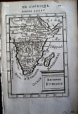 "Ancienne Ethiopie" Paris. Thierry. Denys. 1683
Copper engraved map of Sub-Saharan Africa showing the the Ancient kingdoms, from Mallet's "Description de l'Univers" 1st edition. Text to verso. Dark impression.
152 by 108mm (6 by 4¼ inches). €60
Ascension Island, South Atlantic
 "Ascension Island. " "Isle d'Ascension" Paris. Thierry. Denys. 1683
Copper engraved view of Ascension Island, from Mallet's "Description de l'Univers" 1st edition. Text to verso. Dark impression.
148 by 100mm (5¾ by 4 inches). €40
Canary Islands.
 "Canarie" Paris Thierry. Denys. 1683
Copper engraved view of Las Palmas Gran Canaria, from Mallet's "Description de l'Univers" 1st edition. Text to verso. . Dark impression.
154 by 102mm (6 by 4 inches). €80
Guinea.
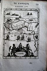 "Guinee" & "P. les de Guinée" Paris. Thierry. Denys. 1683
Copper engraved map of Guinea, and an illustration of the inhabitants thereof. 2 plates, from Mallet's "Description de l'Univers" 1st edition. Text to verso. Dark impressions.
146 by 104mm (5¾ by 4 inches) map. 155x103mm costume. €70
Saint Helena.
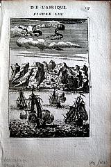 "I de St. Helene" Paris. Thierry. Denys. 1683
Copper engraved view of Jamestown, St. Helena. from Mallet's "Description de l'Univers" 1st edition. Text to verso. Dark impression.
150 by 100mm (6 by 4 inches). €50
La Reunion/ Isle Bourbon, Indian Ocean.
 "I. le Bourbon". Paris. Thierry. Denys. 1683
Copper engraved map of La Reunion/ Isle Bourbon. from Mallet's "Description de l'Univers" 1st edition. Text to verso. Dark impression; dampstaining to lower blank margin.
146 by 102mm (5¾ by 4 inches). €70
Madagascar.
 "Isle de Madagascar dite de St Laurens ou L'isle Daufine" Paris. Thierry. Denys. 1683
Copper engraved map of Madagascar. from Mallet's "Description de l'Univers" 1st edition. Blank verso. Dark impression.
145 by 100mm (5¾ by 4 inches). €100
Capo Verde islands.
 "Isles du Cap-Verd". Paris. Thierry. Denys. 1683
Copper engraved map o fthe Capo Verde Islands, from Mallet's "Description de l'Univers" 1st edition. Text to verso. Dark impression.
151 by 108mm (6 by 4¼ inches). €70
Fez, Marocco.
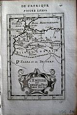 "L'Empire du Cherif de fez Maroc Sus &c" Paris. Thierry. Denys. 1683
Copper engraved map of Fez, Marocco, from Mallet's "Description de l'Univers" 1st edition. Text to verso. Dark impression.
156 by 103mm (6¼ by 4 inches). €30
Canary Islands.
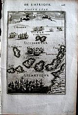 "L'Isles Canaries". Paris Thierry. Denys. 1683
Copper engraved map of the Canary Islands with Madera to the North, from Mallet's "Description de l'Univers" 1st edition. Text to verso. . Dark impression.
151 by 106mm (6 by 4¼ inches). €150
Fes, Marocco & North Africa.
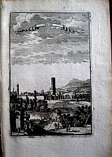 "Marocco" "Marock"; "Salé"; "Tanger, Salé" Paris. Thierry. Denys. 1683
3 Copper engraved views of Fes/ Fez, Salé, & Salé with Tangiers from Mallet's "Description de l'Univers" 1st edition. , 3 plates, text to verso [Tangiers/ Salé]. Others blank to verso. Dark impressions.
155 by 100mm (6 by 4 inches) Fes. 151x105mm Tanger/Salé; 148x105mm Salé. €75
Island of Mozambique, Africa.
 "Mozambique" Paris. Thierry. Denys. 1683
Copper engraved birds eye view of the Island of Mozambique of the north coast of modern Mozambique. from Mallet's "Description de l'Univers" 1st edition. Text to verso. Dark impression.
155 by 102mm (6 by 4 inches). €60
Nubia/Sudan.
 "Nubie" Paris. Thierry. Denys. 1683
Copper engraved map of Nubia, from Mallet's "Description de l'Univers" 1st edition. Text to verso. Dark impression.
148 by 102mm (5¾ by 4 inches). €40
Tenerife, Canary Islands.
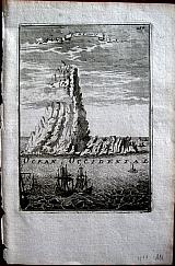 "Pic de Tenerif". Paris. Thierry. Denys. 1683
Copper engraved view of Tenerife from Mallet's "Description de l'Univers" 1st edition. Blank to verso. Dark impressions.
148 by 105mm (5¾ by 4¼ inches). €60
São Tomé & Principe.
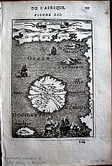 "S. Thomas Island. " "I. St. Thomas" Paris. Thierry. Denys. 1683
Copper engraved map of São Tomé & Principe/ St Thomas. Isle du Prince. Isle Fernando Po. from Mallet's "Description de l'Univers" 1st edition. Text to verso. Dark impression.
152 by 105mm (6 by 4¼ inches). é €60
Source of the Nile & Abyssinia
 "Sources du Nil'" & " Empire des Abissins comme il est presentement". Paris. Thierry. Denys. 1683
2 Copper engraved maps showing the source of the Nile, 1 detailed focusing on Dambea and the other more general. from Mallet's "Description de l'Univers" 1st edition. , 2 plates; text to versos. Dark impression.
155 by 105mm (6 by 4¼ inches) Nile. 150x104mm Abyssinia. €65
Tripoli, Libya; . Barbary Coast.
 "Tripoli" "Plan de Tripoli Barbarie" &" Tripoli de Barbarie"; "Habitants de Barbarie"; " Barbarie". Paris. Thierry. Denys. 1683
Copper engraved view of Tripoli, Libya, with a town plan above, [2 on 1 plate] + map of Barbary Coast, North Africa [4 on 1 plate] with an illustration of the costume of the inhabitants from Mallet's "Description de l'Univers" 1st edition. 3 plates, text to versos.
A decorative view of Tripoli with the town plan set on a banner above. Dark impressions. the map appears to have been pasted over the same map, at the time of publication, perhaps there was a mistake on the previous plate ? Slight show through from lower map.
145 by 107mm (5¾ by 4¼ inches)view. 156x106mm, map. 157x104mm costume €50
East Africa.
 Coast of East Africa. "Costes d'Abex, d'Aian et de Zanguebar" Paris. Thierry. Denys. 1683
Copper engraved map of the coast of East Africa and the Islands, from Mallet's "Description de l'Univers" 1st edition. Text to verso. Dark impression.
148 by 101mm (5¾ by 4 inches). €70
The Barbary Coast North Africa.
 Barbary. "Barbaria" Amsterdam, " Exusum in aedibus Jodici Hondij veneunt etiam apud Corneliu Nicolai. item apud Joannem Janssoniu Arnhemi." 1607
Copper engraved map of the Barbary Coast from the first edition of Gerhard Mercator's "Atlas Minor". Latin text to verso.
The map shows the coast of North Africa and the Mediterranean, above 2 inset maps focusing on Carthage and the Nile Delta. Dark impression; old ink number to upper margin; damp stain to lower right blank margin .
Koeman: Me186. 143 by 186mm (5¾ by 7¼ inches). €100
Egypt.
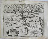 Egypt. "Ægyptus" Amsterdam, " Exusum in aedibus Jodici Hondij veneunt etiam apud Corneliu Nicolai. item apud Joannem Janssoniu Arnhemi." 1607
Copper engraved map of Egypt from the first edition of Gerhard Mercator's "Atlas Minor". Latin text to verso.
The map shows the course of the Nile to the Delta with all the settlements and also the Red sea coast. Dark impression; old ink number to upper margin; damp stain to lower right blank margin just entering image.
Koeman: Me186. 150 by 190mm (6 by 7½ inches). €120

Company: Bryan, Mary Louise.
Address: Ag. Andrianoy 92 , 21 100 Nafplio, Greece.
Vat No: EL 119092581