MAPS & VIEWS
PRINTS
BOOKS


Westphalia, Germany.
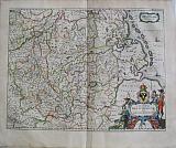 Westphalie. "Circulis Westhalicus sive Germaniœ Inferioris." Amsterdam Apud Guiljelmum et Joahannem Blaeu. 1647
Original coloured, copper engraved map of Westphalia from volume 1 of Joan Blaeu's "Le theatre du Monde ou Nouvel Atlas." Double page; folio; French text to verso.
Large decorative title cartouche with coat of arms, including miniature map of Hamburg. Original colour; short tear near lower centre fold, repaired; lower centre fold split, repaired.
Koeman1, Bl 16A [290(R)] 415 by 535mm (16¼ by 21 inches). €350
Andalucía.
 Andalusia continens Sevillam & Cordubam. "Andaluzia continens Sevillam et Cordubam." Amsterdam Apud Johannem Guiljelmi F. Blaeu. c1655
Original coloured, copper engraved map of Andalucía from volume 2 of Joan Blaeu's "Theatrum Orbis terrarum, sive atlas novus. Pars secunda." Double page; folio; Latin text to verso.
Decorative title cartouche, the title on a lion skin stretched between columns; 2 coats of arms; compass rose, ships and galleys to sea. Bright original outline colour; good impression; light spotting from Corduba to compass rose; damp stain to lower corners and upper edge, far from image.
Koeman1, Bl 24C. 380 by 499mm (15 by 19¾ inches). €375
Artois, Northern France.
 Artesia Comitatus, vulgo Artois. " Artesia Comitatus. Artois" Amsterdam Apud Guiljelmum et Joahannem Blaeu. 1647
Original coloured, copper engraved map of Artois from Blaeu's "Theatrum Orbis terrarum, sive atlas novus .Partis Prima pars Altera." Double page; folio; Latin text to verso.
Strap work title cartouche with scale , flanked by putti and surmounted by coat of arms; compass rose, ship and large fish to sea.
The map shows the County of Artois, now Northen France, The are was to change hands through marriages and wars between France and the Hapsburg Netherlands throughout the middle ages.
Artois in the course of the Franco-Spanish War was conquered by the troops of King Louis XIII of France in 1640 and reverted to French rule by the 1659 Treaty of the Pyrenees. Bright original colour; light damp stain to lower edge of blank margin; small brown spot in upper blamk margin.
Koeman1, Bl 23A. 380 by 500mm (15 by 19¾ inches). €200
Famous Figure Map of Asia.
 Asia. "Asia noiter delineata Auctore Guiljelmo Blaeuw." Amsterdam Apud Johannem Guiljelmi F. Blaeu. c1655
Original coloured, copper engraved figure map of Asia from volume 2 of Joan Blaeu's "Theatrum Orbis terrarum, sive atlas novus .pars secunda." Double page; folio; Latin text to verso.
The famous figure map of Guillaume Blaeu has 9 town views in upper border and 10 costumed figures in side borders, there are numerous galleons and monsters to the sea; a large elephant to the body of the map.
A reduction of Blaeu's famous wallmap of Asia of 1608, the first edition of this map was published in 1630
The map contains extensive details on what was known of Asia in the early 17th century. Korea is still an island. Japan has a predominantly east to west direction. In China, the Great Wall is shown along with the in-land lakes.
The 9 cities depicted above are: Candy, Calecuth, Goa, Damasco, Jerusalem, Ormus, Bantam, Adenand Macao. The vignettes at the sides depict 10 costumes. Bright original outline colour; good impression; small spot to lower left vignette Insulani Sumatræ; to upper centre border just above vignette of Damasco and to right blank margin;light browning to edges of plate mark due to former framing; light toning to edges of page.
Koeman1, Bl 24C. 410 by 555mm (16¼ by 21¾ inches). €4000
River maps: The Rhine and Meuse;
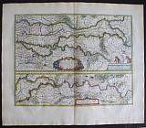 Batavia Vetus, sive Tractus Rheni, & Mosæ, Totiusque Vahallis, a divergio Rheni Gorcomium usque, cum terris adjacentibus Cliviæ, regno Neomgensi, & agro Bommeliano. "Tractus Rheni, & Mosæ, Totiusque Vahallis.... " Amsterdam Apud Guiljelmum et Joahannem Blaeu. 1647
Original coloured, copper engraved maps [2 on 1 plate] of the courses of the rivers Rhine and Meuse from Blaeu's "Theatrum Orbis terrarum, sive atlas novus .Partis Prima pars Altera." Double page; folio; Latin text to verso.
Strap work title cartouche to upper map, scale on plinth with figure and horses; strap work scale to lower map.
2 maps on one page showing the course of the major rivers Rhine, Waal and Maas from Gorinchem in the west to Rheinberck in Germany; the upper map shows the rivers from Gorinchem to Lobet and the lower map shows the continuation from Nijmegen to Rheinberck Original colour; light damp stain to edges of blank margins.
Koeman1, Bl 23A. 385 by 505mm (15¼ by 20 inches). €400
Biscay.
 Biscaia & Guipuscoa. "Biscaia et Guipuscoa Cantabriæ Veteris Pars." Amsterdam Apud Johannem Guiljelmi F. Blaeu. c1655
Original coloured, copper engraved map of Biscay from volume 2 of Joan Blaeu's "Theatrum Orbis terrarum, sive atlas novus. Pars secunda." Double page; folio; Latin text to verso.
Decorative title cartouche and strap work scale flanked by a putti and a cat; ships and compass rose to sea; coat of arms to upper left and empty shield to upper right. Bright original outline colour; good impression; damp stain to lower corners far from image.
Koeman1, Bl 24C. 383 by 500mm (15 by 19¾ inches). €350
The Duchy of Brabant.
 Brabantia Ducatus. "Brabantia Ducatus." Amsterdam Apud Guiljelmum et Joahannem Blaeu. 1647
Original coloured, copper engraved map of the Duchy of Brabant from Blaeu's "Theatrum Orbis terrarum, sive atlas novus .Partis Prima pars Altera." Double page; folio; Latin text to verso.
Decorative title cartouche surmounted by figure and coat of arms; strapwork scale . Bright original colour; light damp stain to edge of lower blank margin also to upper right corner, far from image.
Koeman1, Bl 23A. 380 by 503mm (15 by 19¾ inches). €500
Flemish Brabant : Leuven, Louvain.
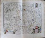 Brabantia pars prima, cujus caput Lovanium. " Pars prima Brabantia, cujus caput Lovanium." Amsterdam Apud Guiljelmum et Joahannem Blaeu. 1647
Original coloured, copper engraved map of Flemish Brabant from Blaeu's "Theatrum Orbis terrarum, sive atlas novus .Partis Prima pars Altera." Double page; folio; Latin text to verso.
Decorative title cartouche surrounded by coats of arms; strapwork scale; coat of arms upper right.
The map shows the area around Leuven in Flemish Brabant. Bright original colour; damp stain to upper corners, far from image.
Koeman1, Bl 23A. 412 by 514mm (16¼ by 20¼ inches). €300
Decorative Map of Northern Brabant.
 Brabantia pars quarta;cujis caput Sylva-Ducis. "Quart Pars Brabantiæ cujus caput Silvaducis." Amsterdam Apud Guiljelmum et Joahannem Blaeu. 1647
Original coloured, copper engraved map of Northern Brabant from Blaeu's "Theatrum Orbis terrarum, sive atlas novus .Partis Prima pars Altera." Double page; folio; Latin text to verso.
Decorative title cartouche; two columns withmunicipal coats of arms to each side surmounted by putti; two large coats of arms of Brabant and 's-Hertogenbosch in each upper corner.
The map prepared by Willibrordus van der Burgt shows Northern Brabant with the capital 's-Hertogenbosch. Bright original colour; light damp stain to edge of lower blank margin; light spot to side blank margins, far from image.
Koeman1, Bl 23A. 412 by 526mm (16¼ by 20¾ inches). €550
Bruxelle, Brussels.
 Brabantia pars secunda, cujus caput Bruxellæ. " Pars secunda Brabantia, cujus caput Bruxellæ." Amsterdam Apud Guiljelmum et Joahannem Blaeu. 1647
Original coloured, copper engraved map of the area around Brussels from Blaeu's "Theatrum Orbis terrarum, sive atlas novus .Partis Prima pars Altera." Double page; folio; Latin text to verso.
Decorative title cartouche surrounded by coats of arms; strap work scale surmounted by putti; coat of arms and compass rose.
The map shows the area around Brussels. Bright original colour; damp stain to upper corners, far from image.
Koeman1, Bl 21A. 412 by 274mm (16¼ by 10¾ inches). €300
Castille, Spain.
 Castella Vetus et Nova. "Utriusque Castlliæ nova descriptio." Amsterdam Apud Johannem Guiljelmi F. Blaeu. c1655
Original coloured, copper engraved map of Castille from volume 2 of Joan Blaeu's "Theatrum Orbis terrarum, sive atlas novus. Pars secunda." Double page; folio; Latin text to verso.
Strap work title cartouche , scale and eplicatio; 3 coats of arms. Bright original outline colour; good impression; damp stain to lower corners and upper edge, far from image.
Koeman1, Bl 24C. 410 by 504mm (16¼ by 19¾ inches). €350
Chile.
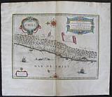 Chili. "Chili." Amsterdam Apud Johannem Guiljelmi F. Blaeu. c1655
Original coloured, copper engraved map of Chile from volume 2 of Joan Blaeu's "Theatrum Orbis terrarum, sive atlas novus .pars secunda." Double page; folio; Latin text to verso.
Large strap work cartouches for title and scale, banner with key small cartouche for author, ships and compass roses to sea. Bright original outline colour; good impression; Printers creases at centre fold; damp stain to edges of blank margins, far from image.
Koeman1, Bl 24C. 357 by 476mm (14 by 18¾ inches). €400
Title Page:"Theatrum Orbis terrarum, sive atlas novus. Pars secunda. Pars Altera"
 Decorative Title Page. ""Theatrum Orbis terrarum, sive atlas novus.Pars secunda. Pars Altera "" Amsterdam Apud Johannem Guiljelmi F. Blaeu. c1655
Original coloured heightened in gold, copper engraved title page from volume 2 of Joan Blaeu's "Theatrum Orbis terrarum, sive atlas novus.Pars secunda." Single page; folio; verso blank.
Title page to the second part of the second volume of Blaeu's"Theatrum Orbis terrarum, sive atlas novus.Pars secunda.".
Architectural portico with 2 Corinthian columns surmounted by stone globes with a decorative armorial with coat of arms of Spain; to each side allegorical figures of the four continents; europe, Asia, Africa and America stand in niches; the title on paste down to centre. Bright original outline colour, heightened in gold; light soiling to blank margins; damp stain to lower right corner of page far from image
Koeman1, Bl 24C. 410 by 252mm (16¼ by 10 inches). €350
South West Holland: Delflandia & Schielandia
 Deflandiæ & Schielandia "Deflandia, Schielandia, et Insula Mosam illis objacentes eu sunt Voorna, Overflackea, Goerea, Yselmonda, etc." Amsterdam Apud Guiljelmum et Joahannem Blaeu. 1647
Original coloured, copper engraved map of South West Holland from Blaeu's "Theatrum Orbis terrarum, sive atlas novus. Partis Prima pars Altera." Double page; folio; Latin text to verso.
Decorative title cartouche; ship and compass rose.
The map shows Rhine–Meuse–Scheldt river delta, with Rotterdam and Delft to the coast. Original colour; soft vertical creases close to centre fold; damp stains to blank margins, far from image.
Koeman1, Bl 21A. 386 by 512mm (15¼ by 20¼ inches). €600
Bergen-op-Zoom and the Fortifications.
 Descriptio Bergarum ad Zomam, Sterbergæ, & novorum ibi operum. "Tabula Bergarum ad Zomam, Sterbergæ, & novorum ibi operum." Amsterdam Apud Guiljelmum et Joahannem Blaeu. 1647
Original coloured, copper engraved map of the area round Bergen-op-Zoom from Blaeu's "Theatrum Orbis terrarum, sive atlas novus .Partis Prima pars Altera." Double page; folio; Latin text to verso.
Strap work title cartouche; inset of Castra Pinsii to lower right.
When the archduchess Isabella had the fortification Zandvliet between Bergen-op-Zoom and Antwerp provided with bullwarks and had a number of fortresses constructed along the Scheldt, the States General decided to construct the three fortresses of Moermont, Pinsen and de Roovere at dangerous points between the swamps to the north of Bergen-op-Zoom. Between these swamps were areas of higher ground over which the enemy could cross. The new line was supposed to protect Zeeland, the shipping routes between Zeeland and Holland, and the northern front of the city of Bergen against the enemy from the new line of defense in 1628 at the request of Prince Frederick Henry. Bright original colour; light damp stain to upper corners and edge of lower blank margin, far from image.
Koeman1, Bl 23A. 225 by 542mm (8¾ by 21¼ inches). €350
Paraguay, South America.
 Descriptio Paraguay sive Provinciæ Rio de La Plata, cum regionibus adjacentibus Tucuman et Santa Cruz de la Sierrra. "Paraguay, o Prov. de Rio de la Plata cum regionibus adiacentibus Tucuman et Sta Cruz de la Sierra." Amsterdam Apud Johannem Guiljelmi F. Blaeu. c1655
Original coloured, copper engraved map of Paraguay from volume 2 of Joan Blaeu's "Theatrum Orbis terrarum, sive atlas novus .pars secunda." Double page; folio; Latin text to verso.
Strap work title catouche; large compass rose.
The map shows the Northern Patagonia territory. Also showing Rio de Janeiro, Sao Paolo, Santa Cruz of Bolivia, Paraguays, Uruguay, Buenos Ayres, Chili and Santo Iago. Bright original outline colour; good impression; damp stain to edges of blank margins, far from image.
Koeman1, Bl 24C. 375 by 478mm (14¾ by 18¾ inches). €350
Sclavonia, Croatia, Bosnia and Dalmatia.
 Descriptio Sclavoniæ, Croatiæ, Bosniæ et Dalmatiæq. "Sclavonia, Croatia, Bosnia cum Dalmatia Parte. Auct. Ger. Mercatorre.." Amsterdam Apud Guiljelmum et Joahannem Blaeu. 1647
Original coloured, copper engraved map of the Dalmatian coast with Sclavonia, Croatia & Bosnia from Blaeu's "Theatrum Orbis terrarum, sive atlas novus ." Double page; folio; Latin text to verso.
The map after Mercator of the countries of the Eastern Balkans.
Decorative title cartouche; three coats of arms of Venice, Hungary and the Ottoman Empire, which all meet in this region. Original colour; light toning to edges of blank margins.
Koeman1, Koeman1, Bl 23A. 385 by 500mm (15¼ by 19¾ inches). €450
The Isthmus of Panama, Costa Rica and Columbia.
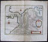 Descriptio Terræ Firmæ, Novi regni Granatensis, et Popayan. "Terra firma et Novum Regnum Granatensis et Popayan." Amsterdam Apud Johannem Guiljelmi F. Blaeu. c1655
Original coloured, copper engraved map of Panama And Columbia from volume 2 of Joan Blaeu's "Theatrum Orbis terrarum, sive atlas novus .pars secunda." Double page; folio; Latin text to verso.
Strap work title catouche and scale; compass roses to sea.
Decorative map of the Isthmus of Panama and North Western South America including most of present day Columbia and part of Venezuela.
Terra Firma is Panama, Veraguas is Costa Rica, and Popayan in the west and Nuevo Rey Node Granada in the east refers to the mountainous Columbia.
The map is significant both for illustrating these early historic areas in the New World and for the numerous settlements, rivers and mountains.
The map is based on the cartography of Hessel Gerritsz. Bright original outline colour; good impression; light damp stain to edges of blank margins, far from image.
Koeman1, Bl 24C. 378 by 490mm (15 by 19¼ inches). €500
Utrecht
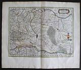 Descriptio Ultraiectum Dominii. "ltraiectum Dominium." Amsterdam Apud Guiljelmum et Joahannem Blaeu. 1647
Original coloured, copper engraved map of the area of Utrecht from Blaeu's "Theatrum Orbis terrarum, sive atlas novus. Partis Prima pars Altera." Double page; folio; Latin text to verso.
Strap worktitle cartouche surmounted by coat of arms; scale held by figure
The map is centred on Utrecht. Original colour; printers creases to left half within plate and also to blank margins; damp stains to blank margins mainly far from image, but light cockling to upper left corner within plate.
Koeman1, Bl 21A. 385 by 502mm (15¼ by 19¾ inches). €350
Sea Chart of Dunkirk.
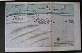 Duinkerka. " Asbeeldinge vande vermaerde seehavenende stadt von Duynkercken met der omliggennde plaetsen sandem ende droochten asgeteekent door Capiteijn Pieter Codde van Enchuysen. Pourtrait de la Fameuse ville et harve de Duynkercke et places voisins, sbles etc. Faict par le Capitaine Pierre Codde d'Enchuse." Amsterdam Apud Guiljelmum et Joahannem Blaeu. 1647
Original coloured, copper engraved sea chart of Dunkirk from Blaeu's "Theatrum Orbis terrarum, sive atlas novus .Partis Prima pars Altera." Double page; folio; Latin text to verso. Title in Dutch and French; 2 sheets joined; full wash colour to land
Numerous ships; compass rose to sea.
The map based on a previous chart prepared by Pieter Codde a sea captain from Enkhuizen in Holland, shows the coast from Dunkirk to Gravelines and beyond with inset at lower right corner of Calais. Bright original colour; light damp stain to lower edge of blank margin; small brown spot at foot of centre fold, far from image.
Koeman1, Bl 23A. 445 by 710mm (17½ by 28 inches). €450
French Flanders.
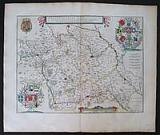 Flandria Gallicana, vulgo Flandre Wallonne " GalloFlandria, in qua Castellaniæ Lillana , Duacena, & Orchiesia, cum dependentibus; necnonTornacum, & Totnacesium. Ayctore Martino Doué Gallo- Flandro." Amsterdam Apud Guiljelmum et Joahannem Blaeu. 1647
Original coloured, copper engraved map of French Flanders from Blaeu's "Theatrum Orbis terrarum, sive atlas novus .Partis Prima pars Altera." Double page; folio; Latin text to verso.
Strap work title cartouche and scale, coat of arms; two corners with decorative Heraldic "trees" of coats of arms.
The map shows French Flanders, the border area with Southern Belgium and Northern France, centred on Lille. Bright original colour; light damp stain to lower edge of blank margin; small brown spot at foot of centre fold, far from image.
Koeman1, Bl 23A. 385 by 505mm (15¼ by 20 inches). €300
West Flanders, Dunkirk.
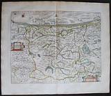 Flandria Teutonicæ pars Occidentalior. " Flandria Teutonicæ pars Occidentalior." Amsterdam Apud Guiljelmum et Joahannem Blaeu. 1647
Original coloured, copper engraved map of West Flanders from Blaeu's "Theatrum Orbis terrarum, sive atlas novus .Partis Prima pars Altera." Double page; folio; Latin text to verso.
Title cartouche and scale surrounded by putti; compass rose and fleet of ships to sea
The map shows in detail the area of Dunkirk in West Flanders. Bright original colour; light damp stain to lower edge of blank margin; small brown spot at foot of centre fold, far from image.
Koeman1, Bl 23A. 393 by 5001mm (15½ by 197 inches). €350
North West Flanders.
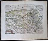 Flandria Teutonicæ pars Orientalior. " Flandria Teutonicæ pars Orientalior." Amsterdam Apud Guiljelmum et Joahannem Blaeu. 1647
Original coloured, copper engraved map of North West Flanders from Blaeu's "Theatrum Orbis terrarum, sive atlas novus .Partis Prima pars Altera." Double page; folio; Latin text to verso.
Title cartouche surrounded by putti; compass rose and ships to sea
The map shows in detail the area of Ghent and Bruges in North West Flanders, and the coastline including part of Zeeland Bright original colour; light damp stain to lower edge of blank margin; small brown spot at foot of centre fold, far from image.
Koeman1, Bl 23A. 380 by 500mm (15 by 19¾ inches). €350
Virginia & Florida.
 Florida. "Virginiæ partis australis et Floridæ partis orientalis, interjacentiumq, regionum Nove Descriptio." Amsterdam Apud Johannem Guiljelmi F. Blaeu. c1655
Original coloured, copper engraved map of Virginia & Florida from volume 2 of Joan Blaeu's "Theatrum Orbis terrarum, sive atlas novus .pars secunda." Double page; folio; Latin text to verso.
Large decorative title catouche ; scale with 2 putti, of which the left has a tail thus 2nd state; ships and compass roses to sea.
Cartographically this map forms a marked improvement on the Jodocus Hondius map of 1606, from which this was largely derived. It also amply illustrates the direction that engraving styles had moved, being more open and florid. The map depicts two nations' interests, both marked by their own coat of arms. The French claim, being largely present day Georgia, rests on the abortive colonial attempts of the 1560s. Blaeu makes no advance here in geography, following Hondius to the letter.
The greatest improvement occurs in the northern half of the map north of Porto Royal. Whereas on the Hondius the coastline towards C. de Ste. Romano (present day Cape Fear) veered directly east, Blaeu more correctly takes it north-east, placing the cape closer to its true position of 34°. This span of coastline is approximately that of present day South Carolina's. This now present to us a more accurately proportioned Outer Banks Region, radically reduced in size but still slightly too far north. For these improvements Blaeu drew upon the extremeley rare DE EYLANDEN ..., by Hessel Gerritsz, c. 1631. The Outer Banks combine the placenames of Gerritsz and Hondius, often using two different ones for the same area such as C. de Trafalgar and C. ost Feare. This latter name was often applied to present day Cape Lookout before it was used for its present site to the south-west.
Chesapeake Bay was depicted as just a small bay on Hondius' map of 1606 as John Smith was yet to explore these waters. The Gerritsz terminated at this point, and only two placenames appeared. Blaeu draws largely on the Smith map for much of the nomenclature but introduces some English ones from an unknown source. The most important is Newport nesa, Newport News, founded in 1621 and apparently shown here for the first time on a printed map. Also new are Bermouth, Stortingen and Arglas. The two Indian figures from Hondius' map form part of the cartouche on Blaeu's. The winged cherub to the left of the scale provides the only difference to the two known states. [Burden: The Mapping of America]
Bright original outline colour; good impression; light damp stain to edges of blank margins, far from image.
Koeman1, Bl 24C.; Burden: 253 State 2. 386 by 506mm (15¼ by 20 inches). €1500
A Never Built Canal between The Rhine and Meuse; the Fossa Eugeniana.
 Fossa S. Mariæ, Quæ & Eugeniana dicta Rhenum Mosamque interduci cœpta anno 1628. "Fossa Sanctæ Mariæ, quæ et Eugeniana dictur Vulgo De Nieuwe Grista " Amsterdam Apud Guiljelmum et Joahannem Blaeu. 1647
Original coloured, copper engraved map of the Dutch provinces of Geldria & Zutphen from Blaeu's "Theatrum Orbis terrarum, sive atlas novus .Partis Prima pars Altera." Double page; folio; Latin text to verso.
Strap work title cartouche; decorative scale flanked by allegorical figures representing the Rhine and Meuse [ Moselle]; decorative dedicatory cartouche to the Infanta Isabellæ Claræ Eugenia of Spain flanked by spades and pickaxes; shields with coats of arms to upper corners; smaller coats of arms either side of Explicatio.
The map shows the Fossa Eugeniana, a never completed canal from the Rhine near Rheinberg to the Meuse near Venlo. Original colour; light damp stain to edges of blank margins.
Koeman1, Bl 23A. 385 by 510mm (15¼ by 20 inches). €400
The Straits of Magellan, Tierra de Fuego. and Le Maire Strait.
 Fretum Magallanicum. Fretum Le Maire. "Tabula Magellanica, quâ Tierræ del fuego, cum celeberrimis fretis F. Magellano at I. Le Maire detectis novissima et acuratissima descriptio exhibetur." Amsterdam Apud Johannem Guiljelmi F. Blaeu. c1655
Original coloured, copper engraved map of Magellanica from volume 2 of Joan Blaeu's "Theatrum Orbis terrarum, sive atlas novus .pars secunda." Double page; folio; Latin text to verso.
3 strap work catouches for title, scale and key; coat of arms and dedication to Constantino Hugenio (Constantijn Huygens, the secretary of the two Princes of Orange, Frederick Henry and William II);; fleet of ships and compass roses to sea.
Ferdinand Magellan discovered and explored the sea route between the mainland of South America and Tierra del Fuego during his circumnavigation of the globe. The natural passage between the Atlantic and the Pacific Ocean is named today Strait of Magellan. Magellan himself died during this journey on 27 April 1521 in the Philippines.
The map bears Willem Blaeu's signature but was published by his son Joan.
The map shows the results of the expeditions of Willem Cornelisz Schouten and Jacob Le Maire (1615-1617), who discovered Cape Horn, and those of the Nassau fleet under admiral Jacques l'Heremite and vice-admiral Gheen Huygen Schapenham (1623-1626). "Lheremitens eylandt" and "Schapenhams bay" are named after these two expedition leaders. Bright original outline colour; good impression; fairly extensive damp stain to edges of blank margins, just touching image.
Koeman1, Bl 24C. 375 by 478mm (14¾ by 18¾ inches). €600
West Friesland.
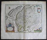 Frisia Occidentalis "Frisia Occidentalis..." Amsterdam Apud Guiljelmum et Joahannem Blaeu. 1647
Original coloured, copper engraved map of West Friesland in Holland from Blaeu's "Theatrum Orbis terrarum, sive atlas novus. Partis Prima pars Altera." Double page; folio; Latin text to verso.
Decorative title cartouche surmounted by coat of arms; scale with figures and horses; strap work explicatio cartouche; compass rose. Original colour; damp stains to blank margins, far from image.
Koeman1, Bl 21A. 383 by 495mm (15 by 19½ inches). €400
Galicia.
 Gallæcia. "Gallæcia.Regnum descripta a F.Fer. Ojea..." Amsterdam Apud Johannem Guiljelmi F. Blaeu. c1655
Original coloured, copper engraved map of Galicia from volume 2 of Joan Blaeu's "Theatrum Orbis terrarum, sive atlas novus. Pars secunda." Double page; folio; Latin text to verso.
Decorative title cartouche on shell borne by Posidon; large coat of arms borne by Putti with music script on banner below compass roses and ships to sea; Bright original outline colour; good impression; damp stain to lower corners far from image; minor printer's crease to left blank margin.
Koeman1, Bl 24C. 383 by 494mm (15 by 19½ inches). €450
Geldria and Zutphen.
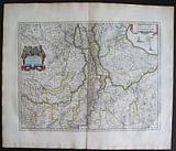 Geldria Ducatus ac Zutphania Comitatus. "Geldria Ducatus et Zutphania Comitatus" Amsterdam Apud Guiljelmum et Joahannem Blaeu. 1647
Original coloured, copper engraved map of the Dutch provinces of Geldria & Zutphen from Blaeu's "Theatrum Orbis terrarum, sive atlas novus .Partis Prima pars Altera." Double page; folio; Latin text to verso.
Decorative title cartouche, with allegorical figure and coats of arms; scale; ships and compass rose to sea.
The map shows Gelderland orientated west at the top, including Northern Limburg, the Eastern part of Brabant, Veluwe and Zutphen;including the towns of Utrecht, Enschede, Rhunbeck, Maaseik, Eindhoven, Gorcum, etc. Original colour; very light damp stain to edge lower blank margin.
Koeman1, Bl 23A. 382 by 503mm (15 by 19¾ inches). €350
Decorative Map of Holland and Belgium. The "Scheepjes Kaart".
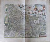 Germania Inferior, sive Belgica Hoderna "Novus XVII Inferioris Germaniae Provinciarum Typus" Amsterdam Apud Guiljelmum et Joahannem Blaeu. 1647
Original coloured, copper engraved map of the XVII Provinces from Blaeu's "Theatrum Orbis terrarum, sive atlas novus .Partis Prima pars Altera." Double page; folio; Latin text to verso.
Large decorative title cartouche, strap work scale and key; annotated compass rose; fleet of ships to coast.
The second state of the map, first published as a wall map in 1608 with figured borders. In 1630 Blaeu's sacrificed the borders [cutting them off the copper plate] to use as the general map of the Low countries in his first atlas The Appendix.
One of the most decorative maps of present Netherlands, Belgium and Luxembourg; with the signature of "Willem Janszoon op't Water in de Vergulde Zonnewyzer."
Bright original colour; light damp stain to edge of lower blank margin; printers crease at centre fold
Koeman1, Bl 23A. 397 by 505mm (15¾ by 20 inches). €1000

Company: Bryan, Mary Louise.
Address: Ag. Andrianoy 92 , 21 100 Nafplio, Greece.
Vat No: EL 119092581