MAPS & VIEWS
PRINTS
BOOKS


The Parthenon, Athens.
 Le Roy Arh.te de.l in Greciâ. Le Bas Sculp.
View of the Temple of Minerva, Athens. "Vue de Temple de Minerva à Athenes." Paris chez H.L. Guerin & L.F. Delatour, J.L. Nyon/ Jean Neaulme 1758
Le Roy Arh.te de.l in Greciâ. Le Bas Sculp.
View of the Temple of Minerva, Athens. "Vue de Temple de Minerva à Athenes." Paris chez H.L. Guerin & L.F. Delatour, J.L. Nyon/ Jean Neaulme 1758Copper engraved view of the gate of the Parthenon, Athens from Le Roy's "Les Ruines des Plus Beaux Monuments de la Grece ." Black and white, verso blank.
The view shows the ruined Parthenon with a small mosque erected by the Turks within. Bright dark impression; small ink spots to blank margins.
Blackmer/ Navari :1009; Atabey 709 ;Cohen de-Ricci 627. 300 by 465mm (11¾ by 18¼ inches). €1000
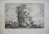
Monument to Philopappus, Athens.
 Le Roy Arh.te de.l in Greciâ. Le Bas Sculp.
View of the Trimphal Monument raised to honour Caius, Julius, Antiochus Philopappus at Athens. "Vue d'un Monument triumphal élevé en l'honeur de Caius, julius, Antiochus, Philopappus à Athenes." Paris chez H.L. Guerin & L.F. Delatour, J.L. Nyon/ Jean Neaulme 1758
Le Roy Arh.te de.l in Greciâ. Le Bas Sculp.
View of the Trimphal Monument raised to honour Caius, Julius, Antiochus Philopappus at Athens. "Vue d'un Monument triumphal élevé en l'honeur de Caius, julius, Antiochus, Philopappus à Athenes." Paris chez H.L. Guerin & L.F. Delatour, J.L. Nyon/ Jean Neaulme 1758Copper engraved view of the Monument of Philopappus, Athens from Le Roy's "Les Ruines des Plus Beaux Monuments de la Grece ." Black and white, verso blank.
The view shows the ruined Monument of Philopaapus with varius figures sitting around it and the sea in the background.
The Philopappos Monument is an ancient Greek mausoleum and monument dedicated to Gaius Julius Antiochus Epiphanes Philopappos or Philopappus, ( 65–116 AD), a prince from the Kingdom of Commagene. It is located on Mouseion Hill in Athens, Greece, southwest of the Acropolis.
Philopappos died in 116, and his death caused great grief to his sister Julia Balbilla, citizens of Athens and possibly to the imperial family. As a dedication to honor the memory of Philopappos, Balbilla with the citizens of Athens erected a tomb structure on Mouseion Hill near the Acropolis of Athens. His marble tomb monument is still known as the Philopappos Monument, and the hill is today known as Philopappos Hill
The Greek geographer Pausanias (Description of Greece, I.25.8), describes Philopappos' grand tomb as a monument built for a Syrian man. The monument was built on the same site where Musaios or Musaeus, a 6th-century BC priestly poet and mystical seer, was held to have been buried. The location of this tomb, opposite the Acropolis and within formal boundaries of the city, shows the high position Philopappos had within Athenian society. Bright dark impression; small minor spots to blank margins.
Blackmer/ Navari :1009; Atabey 709 ;Cohen de-Ricci 627. 309 by 463mm (12¼ by 18¼ inches). €750
Ancient Thoricos, Lavrion Attika
 Le Roy Arh.te de.l in Greciâ. Le Bas Sculp.
View of various fragments of a Temple situated in a part of Attika called Thoricos "Vue du Port de Piée à Athenes." Paris chez H.L. Guerin & L.F. Delatour, J.L. Nyon/ Jean Neaulme 1758
Le Roy Arh.te de.l in Greciâ. Le Bas Sculp.
View of various fragments of a Temple situated in a part of Attika called Thoricos "Vue du Port de Piée à Athenes." Paris chez H.L. Guerin & L.F. Delatour, J.L. Nyon/ Jean Neaulme 1758Copper engraved view of ancient Thoricos, now called Lavrion, Attika from Le Roy's "Les Ruines des Plus Beaux Monuments de la Grece ." Black and white, verso blank.
The view shows the ruins of a Doric temple in the foreground with the harbour in the midground and the island of Makronisi (Macri) behind. ThLe Roy peoples the scene with various figures, some of whom seem to be excavating the ruins and taking measurements whilst others in European dress look on.
Thoricus was an ancient Greek city in southern Attica, where lead and silver was mined. Thoricus was the mining centre of the Laureotica. There is evidence of lead extraction from the 3rd millennium BC and of silver from 1500 BC. large Doric temple (late 5th century BC), may have been a Telesterion for the cult of Demeter and Persephone Good impression; light spotting to blank margins.
Blackmer/ Navari :1009; Atabey 709;Cohen de-Ricci 627. 304 by 467mm (12 by 18½ inches). €450
Scarce French map after Ortelius's "Graecia Sophiani".
 "H LeRoy Fecit"
Greece. "Ελλαs. Graecia Sophiani." "A Paris " "Chez N Langlois rue Saint Jaques àla Victoire" c1640-60
"H LeRoy Fecit"
Greece. "Ελλαs. Graecia Sophiani." "A Paris " "Chez N Langlois rue Saint Jaques àla Victoire" c1640-60Copper engraved map of Greece after Ortelius by Henri Le Roy. Original outline colour; verso blank.
Decorative title cartouche and scale.
The map by Henri Le Roy seems to have first been published by Michel Van Lochom in 1636 and then by J Boisseau in 1643 in his " Tresor des Cartes Géographiques". Thereafter the plate seems to have passed through a number of hands including that of Pierre Mariette who was stepfather to Nicolas Langlois the present publisher. Dark impression; signs of former framing, leading to toning and tape to edges on verso; dampstain to lower margin; centrefold split, due to removal of guard, repaired to verso.
This edition not in Zacharakis [ Zacharakis; 2019/1344, 2020/1345, 2021/1346 and 451/274 variants] 355 by 488mm (14 by 19¼ inches). €850
Scarce Lithograph of Parga, Epirus.
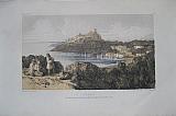 Parga. "Parga" London Richard Bentley. 1851
Tinted lithograph of Parga from Edward Lear's " Journals of a Landscape Painter in Albania, Illyria &c." [ plate 18]
The image shows Parga, looking down upon the bay and across to the castle .
Throughout his life, Lear was an adventurous traveller and kept detailed journals of his trips. Among the places he visited in his life were Ceylon (now Sri Lanka), Italy, Greece, Turkey and Egypt.
On Lear's visit to Calabria it was a disgusted young Englishman who referred to him as, ' "nothing but a damned, dirty landscape painter" '. This insult, Lear cheerfully adopted as his sobriquet.
One of his adventures took him for the first time to Albania and Macedonia – quite by accident, as he was attempting to return home after a trip to Thessaloniki in Greece in 1848 when a cholera outbreak forced him to take the overland route through the Balkans. Travelling through a land that was even more mysterious to foreigners than it is today – "to the unlearned tourist, indeed, Albania is a puzzle of the highest order", he wrote – and certainly not a typical holiday destination, Lear recorded copious notes of the things and people he encountered on the journey, as well as making many sketches.
The diaries and paintings that resulted from this trip were published in 1851 in "Journal of a Landscape Painter in Greece and Albania". On his extensive journey from the latter months of 1848, the places he visited included Tirana, Shkodra, Durres, Kruja and Berat. Today, there is an art museum in Berat that bears Lear's name, a testament to the high esteem in which Albania holds the work of the artist, not to mention the effect his words and images had in demystifying their land and culture. Light soiling and foxing mainly to blank margins; lithographer's pinholes to corners of image as usual.
Blackmer/ Sothebys:1318 ; Navari :986 [1st edition]. 152 by 252mm (6 by 10 inches). €120
View of the Acropolis, Athens.
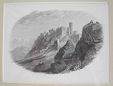 Athens. Athens. London The Artists, St John's Wood. 1857
Steel engraving view of the Acropolis and Athens from Linton's The Scenery of Greece and its Islands..Black and white as issued.
The view shows the Acropolis and the the rock of Areopagus; viewed from below Areopagus the vieew shows part of the propylion and the Venetion tower. Clean and bright, under passepartout.
150 by 220mm (6 by 8¾ inches). €80
Andravida, Ellis, N.W Peloponnesus.
 Andravida. "Antrivida." Nürnberg/ Nuremberg. Loschge Leonhard. 1687
Extremely scarce small copper engraved view of Andravida in Ellis, North West Peloponnesus from Loschge's "Neue vermehrte Beschreibungder trflichen Halbinsel Morea mit den Angrezenten Inseln und Provinzen des Coronelli und andern Italianischen Schriften"
Modern hand colour.
Andravida's early history is obscure: the name is of unknown provenance—several proposals have been made, the most probable of which is that it derives from a Slavic name for "place of the otters"—and the site is not mentioned before the conquest by the Crusaders in 1205, even though it certainly existed before that. According to the Chronicle of the Morea, Andravida, like most of the towns and regions of the northern and western Peloponnese, was captured without a fight in 1205 by the Crusader leader William of Champlitte, and it was there that the local Greek magnates and lords of Elis and of the mountains of Skorta and Mesarea paid him homage and recognized him as their lord.
Soon after the Frankish conquest, Andravida (known as Andreville in French, Andrevilla in Aragonese and Andravilla in Italian) became the residence of the princes of the newly established Principality of Achaea. As the medievalist Antoine Bon points out, Andravida's choice as the de facto capital of the principality rested on its favourable location: situated in the midst of the fertile plain of Elis, it was well provisioned and could sustain horses, it was located near the major port town of Glarentza, but not on the coast and hence not vulnerable to seaborne raids, and was equally far from the mountains of the central Peloponnese with their rebellious inhabitants. Consequently, despite its importance, it was never fortified. The town also became the seat of a Roman Catholic bishopric, attested since 1212, which assimilated the pre-existing Greek bishopric of Olena and retained the latter's name. Dark impression; modern hand colour; mounted.
Not In Zacharakis but description of maps Nos 2080-2101. 65 by 115mm (2½ by 4½ inches). €160
Messenia called Arcadia Inferior, Peloponnesus.
 Arcadia Inferior [ Modern Messenia} "Arcadia Inferior." Nürnberg/ Nuremberg. Loschge Leonhard. 1687
Extremely scarce small copper engraved map of Messenia and part of Arcadia called Arcadia Inferior, Peloponnesus, from Loschge's "Neue vermehrte Beschreibungder trflichen Halbinsel Morea mit den Angrezenten Inseln und Provinzen des Coronelli und andern Italianischen Schriften"
Modern hand colour.
The map shows the area surrounding the gulf of Messania, north to Oichalia including Mantinea. Most of the names are in Latin. Good impression; modern hand colour; upper margin short due to binding; old ink numbers to borders.
Zacharakis:2090. 66 by 114mm (2½ by 4½ inches). €150
Argia, Argolis North Eastern Peloponnesus.
 Argia. "Argia" Nürnberg/ Nuremberg. Loschge Leonhard. 1687
Extremely scarce small copper engraved map of part of Argolis Peloponnesus, from Loschge's "Neue vermehrte Beschreibungder trflichen Halbinsel Morea mit den Angrezenten Inseln und Provinzen des Coronelli und andern Italianischen Schriften"
Modern hand colour.
The map shows the area around Argos, Nemea ,part of the coast on the bay of Nafplion and the coast on the Saronic Gulf with Epidavros [ Wronly named the Cointhian Gulf in the map].Most of the names are in Latin. Good impression; modern hand colour; upper margin short due to binding; old ink numbers to borders.
Zacharakis:2082. 66 by 114mm (2½ by 4½ inches). €150
Scarce Miniature Map of Corfu.
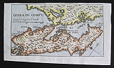 Island of Corfu. "Isola di Corfu" Nürnberg/ Nuremberg. Loschge Leonhard. 1687
Extremely scarce small copper engraved map of Corfu,Kerkyra, from Loschge's "Neue vermehrte Beschreibungder trflichen Halbinsel Morea mit den Angrezenten Inseln und Provinzen des Coronelli und andern Italianischen Schriften"
Modern hand colour.
The map shows the the island with part of the coast of Epirus. Good impression; modern hand colour.
Zacharakis:2091. 66 by 114mm (2½ by 4½ inches). €250
Scarce Miniature Map of Kefalonia.
 Kefalonia. "Isola di Cefalonia" Nürnberg/ Nuremberg. Loschge Leonhard. 1687
Extremely scarce small copper engraved map of Kefalonia, from Loschge's "Neue vermehrte Beschreibungder trflichen Halbinsel Morea mit den Angrezenten Inseln und Provinzen des Coronelli und andern Italianischen Schriften"
Modern hand colour.
The map shows the the island with her major castles and part of the coasts of Lefkada and Epirus. Good impression; modern hand colour.
Zacharakis:2095. 66 by 114mm (2½ by 4½ inches). €250
Korinthia, North Peloponnesus.
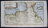 Korinthia & Sicyonia "Corinthia et Sicyonia" Nürnberg/ Nuremberg. Loschge Leonhard. 1687
Extremely scarce small copper engraved map of Korinthia, Peloponnesus, from Loschge's "Neue vermehrte Beschreibungder trflichen Halbinsel Morea mit den Angrezenten Inseln und Provinzen des Coronelli und andern Italianischen Schriften"
Modern hand colour.
The map shows Korinthia, Ancient Sicyonia and Isthmia, showing the korinthian ans Saronic gulfs with Salamis. Most of the names are in Latin. Good impression; modern hand colour; upper margin short due to binding; old ink numbers to borders.
Zacharakis:2081. 66 by 114mm (2½ by 4½ inches). €150
Koroni, Messinia, SW Peloponnesus,
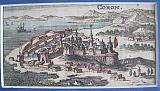 Koroni. "Coron." Nürnberg/ Nuremberg. Loschge Leonhard. 1687
Extremely scarce small copper engraved view of the castle and town of Koroni, Messinia, Peloponnesus from Loschge's "Neue vermehrte Beschreibungder trflichen Halbinsel Morea mit den Angrezenten Inseln und Provinzen des Coronelli und andern Italianischen Schriften"
Modern hand colour
Koroni is a castle with impressive fortifications at the south western end of Peloponnese which existed since the 7th century AD and was completed and reconstructed by the Venetians in the 13th century. The city flourished in the following centuries, but it was constantly in the middle of the long conflict between Venetians and Turks.As many castles in Peloponnese, the city became important and flourished after the 13th century and the Frankish occupation.
Following the fall of Constantinople to the Fourth Crusade in 1204, a Venetian fleet under Premarini and the son of Dandolo occupied it in 1206, and converted the port into a provisioning station "where all passing ships could receive a month's rations", a custom maintained, we are told, when the place became a regular Venetian colony.
Since 1205 Koroni belonged to the Frankish Principality of Achaea. In 1209, the ruler of Achaea Geoffroi de Villehardouin I had no choice than to cede officially the castle-city to the Venetians.
The Venetians made a major reconstruction and expansion of the castle which finished around the end of that century.
The fortress and town were captured by the Ottoman troops of Sultan Bayezid II, who led personally the operation, in 1500.
In 1532, the Habsburg emperor Charles V ordered the Genoese admiral Andrea Doria to attack Koroni as a diversion to the Turkish campaigns in Hungary. Doria managed to capture the city, and to lay waste to the surrounding coast.
In spring 1533, the Ottoman Emperor Suleiman the Magnificent sent 60 galleys to retake the city. They blockaded the harbour, but they were defeated by Doria, highlighting the weakness of the Ottoman Navy at that time. An Ottoman land army however was successful in laying a siege around the city, forcing its surrender on 1 April 1534. The weakened Spanish garrison was allowed to leave the city unharmed
In 1685 the Venetians under general Morozini returned and stayed until 1715. But the golden age of the city was not revived. Dark impression; modern hand colour; mounted.
Not In Zacharakis but description of maps Nos 2080-2101. 60 by 115mm (2¼ by 4½ inches). €140
Leontari, Arcadia, Peloponnesus.
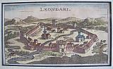 Leontari. "Leondari" Nürnberg/ Nuremberg. Loschge Leonhard. 1687
Extremely scarce small copper engraved view of Leontari, Peloponnesus from Loschge's "Neue vermehrte Beschreibungder trflichen Halbinsel Morea mit den Angrezenten Inseln und Provinzen des Coronelli und andern Italianischen Schriften"
Modern hand colour.
The castle of Leontari has been a Byzantine castle-city that flourished mainly in the 14th century. It was a military base for the Paleologi dynasty and one of the major cities of the Despotate of Mystras. Dark impression; modern hand colour; mounted.
Not In Zacharakis but description of maps Nos 2080-2101. 65 by 114mm (2½ by 4½ inches). €150
Megalopolis, Arcadia, Peloponnesus.
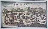 Megalopolis. "Bellveder" Nürnberg/ Nuremberg. Loschge Leonhard. 1687
Extremely scarce small copper engraved view of Megalopolis Peloponnesus from Loschge's "Neue vermehrte Beschreibungder trflichen Halbinsel Morea mit den Angrezenten Inseln und Provinzen des Coronelli und andern Italianischen Schriften"
Modern hand colour.
The city was founded in 371 BC by the Theban general Epaminondas in an attempt to form a political counterweight to Sparta. It was one of the 40 places that were megále pólis (great city). Megalopolis became the seat of the Arcadian League in 370 BC, which in the 3rd century BC became the Achaean League. In 331 BC, Megalopolis was invaded by the Spartans and there was a battle with the Macedonians that came to Megalopolis' help. The Macedonians defeated the Spartans. In 223 BC, the Spartan king Cleomenes III burnt down the city but it was reinstated by Philopoemen, the general of the Achaean League. The city was abandoned during the Middle Ages. The nearby village of Sinano (Σινάνο), situated south of the ancient city, was renamed Megalopoli after Greek Independence. Dark impression; modern hand colour; mounted.
Not In Zacharakis but description of maps Nos 2080-2101. 65 by 115mm (2½ by 4½ inches). €120
Messenia, Peloponnesus,
 Messenia. "Messania." Nürnberg/ Nuremberg. Loschge Leonhard. 1687
Extremely scarce small copper engraved map of Western Messenia, Peloponnesus from Loschge's "Neue vermehrte Beschreibungder trflichen Halbinsel Morea mit den Angrezenten Inseln und Provinzen des Coronelli und andern Italianischen Schriften"
Modern hand colour
The map shows in detail the area of Western Messania; Messini, & Pylos-Nestoras with the small islands offshore to the east with less detail "Arcadiae Pars", modern Messinia to Mount Tayegetus. Good impression; modern hand colour; slight creasing; upper margin short due to binding; old ink numbers to borders; mounted.
Zacharakis:2087/2751 66 by 114mm (2½ by 4½ inches). €180
Methoni, Messania, S.W. Peloponnesus,
 Methoni. "Modon" Nürnberg/ Nuremberg. Loschge Leonhard. 1687
Extremely scarce small copper engraved view of the castle and town of Methoni, Messinia, Peloponnesus from Loschge's "Neue vermehrte Beschreibungder trflichen Halbinsel Morea mit den Angrezenten Inseln und Provinzen des Coronelli und andern Italianischen Schriften"
Modern hand colour
Methoni was built by the Venetians after 1209 at a strategic location, on a rock penetrating the sea and is separated from the land by an artificial moat. The Venetians started having their eye on the harbour of Methoni since the 12th century, since 'it was in the middle of the route from Venice to the East'. Moreover, in 1125, they had launched an attack against the pirates who used it as a shelter, because they had captured Venetian traders on their way home from the East The Venetians occupied Methoni.In 1206, and their domination was established in the spring of 1209 with a treaty signed with Villehardouin, who made all the necessary consents that would guarantee him the help of Venice for the final subordination of the Peloponnese. The Venetians fortified Methoni, which developed, as well as Koroni, into an important trade center with great prosperity.
The Ottoman Turks captured the town in 1500 and despite many attempts and seiges it would not fall until the venetians retook it in 1686.
During the whole of the 16th and 17th century, even though the look of Methoni has not changed, the decline in all sectors was obvious. In June 1686 the forces of Morozini had Methoni under siege. The Turks surrendered on the 10th of July. The walls, that suffered substantial damages during the siege were repaired and new inhabitants were sent to reinforce the population of the town. However, this second period of Venetian occupation did not last for long. In 1715 the Turks launched a siege to the castle and the Venetian defenders, deserted it. During this second period of Turkish occupation, the decline was complete. As is apparent from travelers´ descriptions, the population was reduced, the battlements were in bad condition and the harbour became shallow. The most important trade conducted was that of slaves. Dark impression; modern hand colour; mounted.
Not In Zacharakis but description of maps Nos 2080-2101. 57 by 112mm (2¼ by 4½ inches). €140
Navarino, Pylos,Messenia, Peloponnesus,
 Navarino. "Navarino" Nürnberg/ Nuremberg. Loschge Leonhard. 1687
Extremely scarce small copper engraved map of Navarino and Pylos in Messania Peloponnesus from Loschge's "Neue vermehrte Beschreibungder trflichen Halbinsel Morea mit den Angrezenten Inseln und Provinzen des Coronelli und andern Italianischen Schriften"
Modern hand colour
The map shows the area & position of Navarino, modern Pylos with the castle guarding the bay which a large ship is approaching. The map mentions three names the Franco Italian Porto Zonchio, a Greek one, Avarinos later shortened to Varinos or lengthened to Anavarinos which became Navarino in Italian and Navarin in French and Pila from Pylos its ancient name down to Byzantine times,. Good impression; modern hand colour; slight creasing; upper margin short due to binding; mounted.
Zacharakis:2100. 66 by 114mm (2½ by 4½ inches). €200
Passavas Castle, Laconia Mani. Peloponnesus.
 Passavas. "Passava" Nürnberg/ Nuremberg. Loschge Leonhard. 1687
Extremely scarce small copper engraved view of the castle of Passavas, Laconia, Mani, Peloponnesus from Loschge's "Neue vermehrte Beschreibungder trflichen Halbinsel Morea mit den Angrezenten Inseln und Provinzen des Coronelli und andern Italianischen Schriften"
Modern hand colour
Passavas or Las ) is situated on the Mani Peninsula. In ancient times Las was a Spartan possession and in 218 BC the citizens of the city fought and routed and group of Philip V of Macedon's army. Las became part of the Union of Free Laconians in 195 BC when it separated from Sparta. The Spartans however recaptured the city in 189 BC. Sparta was then taken over by the Achaean League and Las gained its independence again. When the Romans took over most of Greece in 146 BC, Las and the other Free Laconian city continued to have independence. In Roman times, Las had a bath and a gymnasium.
The site is not mentioned in Byzantine times until the Frankish conquest of the Peloponnese, when Mani was given to the Baron Jean de Neuilly (or de Nully), who built a castle at Las. This castle became known as Passavant or Passavas, most probably after the family motto which was: Passe-Avant, "move forward"). Passavas was a small but important barony because it held the unruly Maniots at bay. When the prince of Achaea, Prince William II Villehardouin was defeated and captured at the Battle of Pelagonia, the Baron Jean de Neuilly was captured as well. Then, the Barony of Passavant passed to his daughter Margaret of Passavant, widow of the Lord of Lisarea Guibert de Cors (or d'Escors).[1][2] She was forced to give up her castle and her barony as part of Villehardouin's ransom.[3][4][5]
The castle was in use once again during the second Byzantine domination. The castle of Passavas was occupied by the Ottomans for a short time when they took over the majority of the Peloponnese, in a failed attempt to keep control over the Maniots who refused to accept Ottoman rule. In 1601, a Spanish fleet led by Alonso de Contreras that was raiding in the area surprised the Ottoman garrison and sacked the city. It was regarrisoned in 1669, by the Ottoman general Kuesy Ali Pasha. The castle was captured again in 1684 by the Venetians and the Maniots. The Venetians carried off the cannons and destroyed the city so it would not be used again. When the leader of the Maniots was executed by the Ottomans, his mother led the men of Skoutari who dressed up as priests on Easter Sunday and were allowed entry to the castle. When they got in they took out their hidden weapons and not many of the 700 families inhabiting the castle escaped. The castle was abandoned after that and has not been inhabited since. Dark impression; modern hand colour; mounted.
Not In Zacharakis but description of maps Nos 2080-2101. 65 by 115mm (2½ by 4½ inches). €120
Patras, W. Peloponnesus.
 Patras. "Patrasso" Nürnberg/ Nuremberg. Loschge Leonhard. 1687
Extremely scarce small copper engraved view of Patras, Peloponnesus from Loschge's "Neue vermehrte Beschreibungder trflichen Halbinsel Morea mit den Angrezenten Inseln und Provinzen des Coronelli und andern Italianischen Schriften"
Modern hand colour.
The view shows the city built at the foothills of Mount Panachaikon, overlooking the Gulf of Patras.In 1205 the city was captured by William of Champlitte and Villehardouin, and became a part of the principality of Achaea. It became the seat of the Barony of Patras, and its Latin archbishop primate of the principality. In 1387 Juan Fernández de Heredia, grand master of the order of the Knights Hospitaller at Rhodes, endeavoured to make himself master of Achaea and took Patras by storm. In 1408, Patras became Venetian, until it was recaptured in 1430 by the Despotate of Morea and its despot Constantine Palaiologos, who thus succeeded in recovering for the Byzantine Empire the whole of the Morea, apart from Venetian possessions. The administration of Patras was given to George Sphrantzes, while Constantine was immediately contested by the Ottoman Empire and later, in 1449, became emperor of the Byzantine empire.[8]
Patras remained a part of the Despotate of Morea until 1458, when it was conquered by the Sultan of the Ottoman Empire, Mehmet II. Under the Ottomans, it was known as Baliabadra, from the Greek Παλαιά Πάτρα ("Old Patras"), as opposed to Νέα Πάτρα, the town of Ypati in Central Greece. Though Mehmet granted the city special privileges and tax reductions, it never became a major centre of commerce. Venice and Genoa attacked and captured it several times in the 15th and 16th centuries, but never re-established their rule effectively, except for a period of Venetian rule in 1687–1715. Dark impression; modern hand colour; mounted.
Not In Zacharakis but description of maps Nos 2080-2101. 65 by 114mm (2½ by 4½ inches). €180
Sikyon, Peloponnesus.
 Sikyon. "Sitionia" Nürnberg/ Nuremberg. Loschge Leonhard. 1687
Extremely scarce small copper engraved view of Sikyon, Peloponnesus from Loschge's "Neue vermehrte Beschreibungder trflichen Halbinsel Morea mit den Angrezenten Inseln und Provinzen des Coronelli und andern Italianischen Schriften"
Modern hand colour. Dark impression; modern hand colour; mounted.
Not In Zacharakis but description of maps Nos 2080-2101. 65 by 114mm (2½ by 4½ inches). €160
The Straits of Lepanto, North Peloponnesus.
 Straits of Lepanto "Dardenelli di Lepanto" Nürnberg/ Nuremberg. Loschge Leonhard. 1687
Extremely scarce small copper engraved map of the straits of Lepanto, Peloponnesus, from Loschge's "Neue vermehrte Beschreibungder trflichen Halbinsel Morea mit den Angrezenten Inseln und Provinzen des Coronelli und andern Italianischen Schriften"
Modern hand colour.
The map shows the straits of Lepanto at the entrance of the Korinthian Gulf , with the 2 castles that protect it. Small ships to sea. Good impression; modern hand colour.
Zacharakis:2099. 66 by 114mm (2½ by 4½ inches). €150
Crete with a Prospect, Panoramic view of Iraklion.
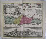 The island of Crete and the adjacent islands of the Aegean with the new island of Santorini ... "Insuls Creta nunc Candia in sua IV Territoria distinicta, cum aliqoud adjacentibus Ægei maris Insulis imprimis Nova Santorini insula modo ante XXVII annos ex abysso marsi emersa..."
"Creta nunc Candia" Augsburg, Lotter Conrad Tobias 1772
Copper engraved map of Crete with View of Iraklion after Seutter from Lotters "Atlas Novus." . Original old colour; verso blank
The map shows the island of Crete, taken from the Homann map of 1712 { Zacharakis 1641/1879] with the a long text beside the newly emerged island at Santorini following the volcanic eruption of 25th May 1707: "In 1707, activity began again, the small when two cones appeared. They were called Aspronisi and Macronesi. Those were united in the course of the following five years by an island which formed between Palea and Small Kameni, much larger and higher then either and was called Nea (New) Kameni .This island, is the youngest island in Greece."[Santorini Living ]
Below is a panaromic view of Iraklion, black & white as issued.
The map was first published by Lotter's father-in-law Matthaüs Seutter in his "Atlas Novus" in 1728 who took the lower part of Homann's map re-engraved the cartouche and text and added the scale to the right half of the map. Seutter then added the panoramic view below the map. . Seutter is renowned for his detailed plans and prospects of cities which appeared in his "Atlas Novus".
Decorative title cartouche with imprint of Lotter replacing that of Seutter. The vignette shows a Janissary overseeing 2 turkish sailors loading cargo; grapes and wine barrels adorn the pedestal; in the background a large sailing ship and on the mountains a herd of Kri-Kri the indiginous capricorn of Crete.
The view with title to sky. Good dark impression; 4 small worm holes near title of view, 2 more near seashore of castle. The map was bound in an atlas at he left margin, but folded at centre [ hence the pairs of wormholes]; crease to left side up to the cartouche and also to upper right corner; light soiling to margins, ink stamp removed to lower right margin. A good example of a scarce prospect/map.
Zacharakis:2103/1308 500 by 561mm (19¾ by 22 inches). €1500
Lefkada, Kefalonia, Zakynthos, Ionian Islands.
 " I. de s. te Maure, Cefalonie, Zante. &c. " Paris Thierry. Denys. 1683
Copper engraved map of the Ionian Islands of Lefkada, Kefalonia, Ithaki/ Ithaka and Zakynthos/ Zante. from Mallet's "Description de l'Univers" 1st edition. Text to verso. Dark impression; printed slightly crooked on the page.
Zacharakis 2155/1419 152 by 106mm (6 by 4¼ inches). €100
Iraklion, Crete.
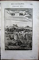 "Candie". Paris Thierry. Denys. 1683
Copper engraved view of Iraklion, called by the Venetians "Candia" from Mallet's "Description de l'Univers" 1st edition. Text to verso. Dark impression.
148 by 100mm (5¾ by 4 inches). €80
Costumes of Chios. North Aegean
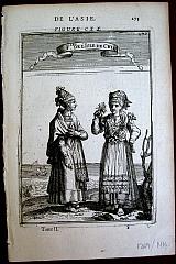 "F. les de l'Isle de Chio". Paris Thierry. Denys. 1683
Copper engraved illustration of female costumes in the island of Chios, from Mallet's "Description de l'Univers" 1st edition. Text to verso. Dark impression; "FIGURE CXX" inside platemark but not within the printed area.
161 by 111mm (6¼ by 4¼ inches). €50
Greece/ Balkan Peninsular.
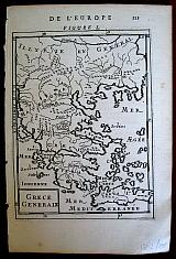 "Grece Generale". Paris Thierry. Denys. 1683
Copper engraved map of Greece and the Balkan Peninsular until Illyria. from Mallet's "Description de l'Univers" 1st edition. Text to verso. Dark impression.
Zacharakis 2137/1401. 160 by 118mm (6¼ by 4¾ inches). €80
Peleponnesus and Southern Greece.
 "Grece Particuliere". Paris Thierry. Denys. 1683
Copper engraved map of Southern Greece, focusing on the Peleponnesus, from Mallet's "Description de l'Univers" 1st edition. Text to verso.
. Dark impression; inner left margin 5mm
Zacharakis 2139/1403 157 by 118mm (6¼ by 4¾ inches). €70
Kythera. Ægina & Peloponnesus.
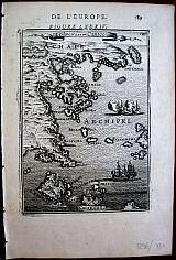 "I. d'Ingna et de Cerigo". Paris Thierry. Denys. 1683
Copper engraved map of the West coast of the Peloponnesus; Kythera; the gulf of Salamis, and the southern coast of Attika to Athens. from Mallet's "Description de l'Univers" 1st edition. Text to verso. Dark impression.
Zacharakis 2148/1412 150 by 106mm (6 by 4¼ inches). €70
Mount Athos, Greece.
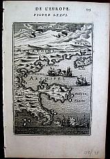 "I. de Tasso et Montesanto". Paris Thierry. Denys. 1683
Copper engraved map of Mont Athos, the coast of Macadonia, Greece and the Island of Thassos. from Mallet's "Description de l'Univers" 1st edition. Text to verso. Dark impression.
Zacharakis 2142/1406 150 by 106mm (6 by 4¼ inches). €70

Company: Bryan, Mary Louise.
Address: Ag. Andrianoy 92 , 21 100 Nafplio, Greece.
Vat No: EL 119092581